 A long-time contributor to open-source mapping, @maptiler.bsky.social joins MapLibre as a silver sponsor
Read more  https://maplibre.org/news/2025-03-31-maptiler-announcement/

maplibre.orgMapTiler becomes a MapLibre Silver Sponsor

A long-time contributor to open-source mapping, @maptiler.bsky.social joins MapLibre as a silver sponsor
Read more https://maplibre.org/news/2025-03-31-maptiler-announcement/
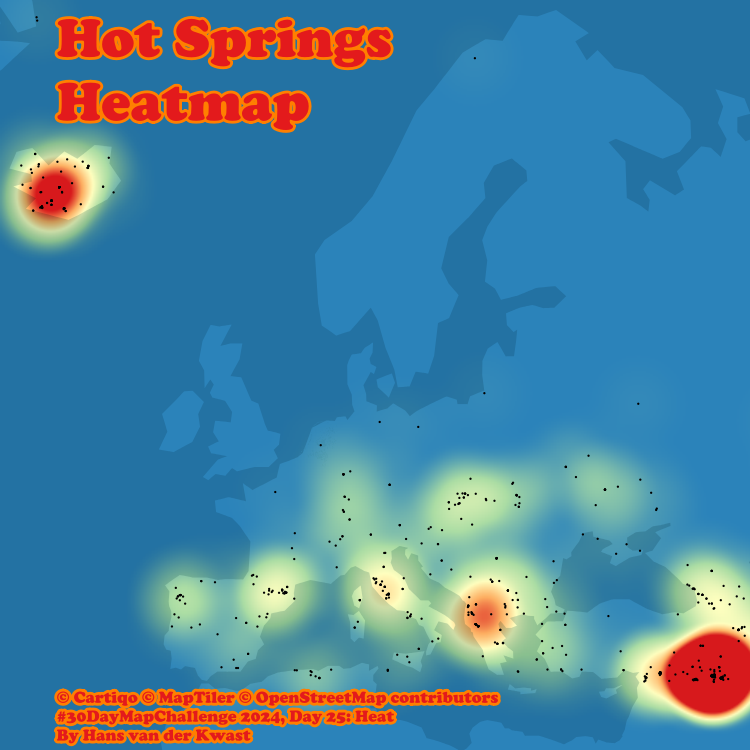
#30DayMapChallenge Day 25: Heat 
#HeatMap of #hotsprings in Europe using #QGIS. #OpenData from #OpenStreetMap, backdrop from #Cartiqo via the #MapTiler plugin. A heatmap shows data density with a colour ramp with warmer colours for higher densities. #GIS #Mapping
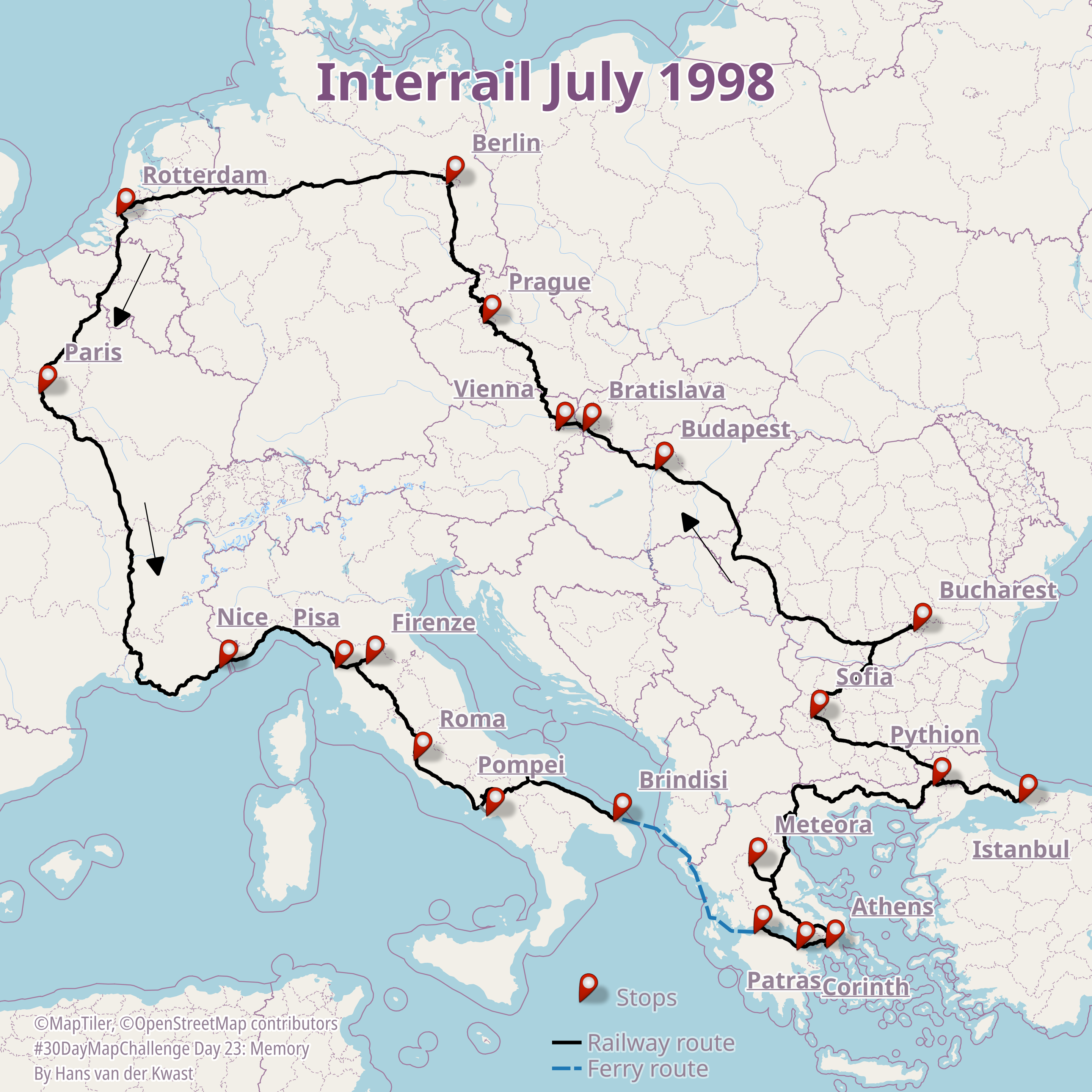
#30DayMapChallenge Day 23: Memory
Fond memories of a month-long Interrail trip with friends . Fun way to explore Europe! Recreating our route from memory was tricky! Map made with #QGIS with selected railways from Natural Earth data & backdrop #OSM #vectortile via #MapTiler.
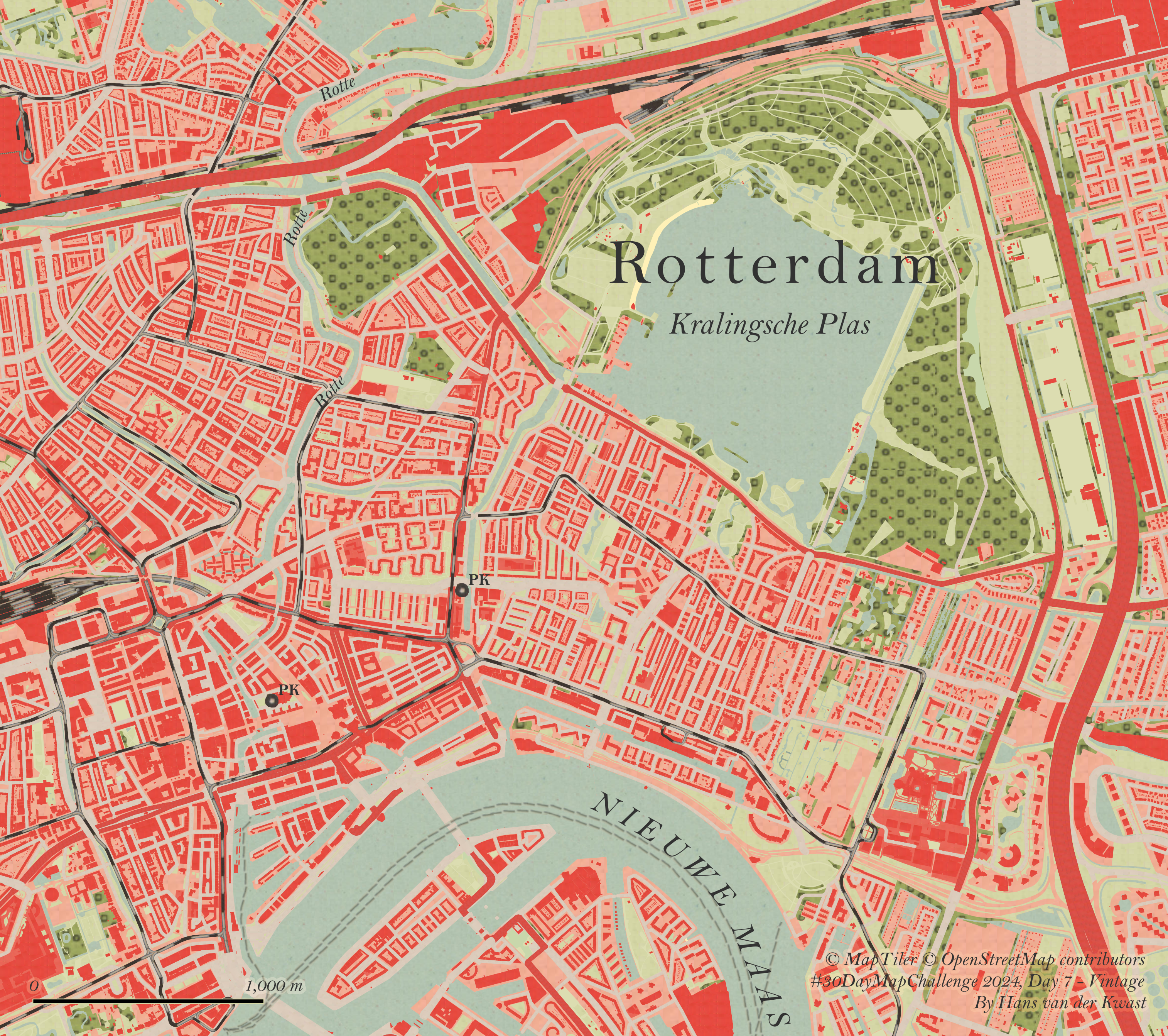
#30DayMapChallenge Day 7: Vintage
I explored beautiful historic maps of #Rotterdam using the TopoTijdReis plugin in #QGIS. Sampled colours from a 1948 map and adjusted the #OpenStreetMap #VectorTile from #MapTiler with the samples using Symbol layer types Raster Image Fill and Raster Line. 

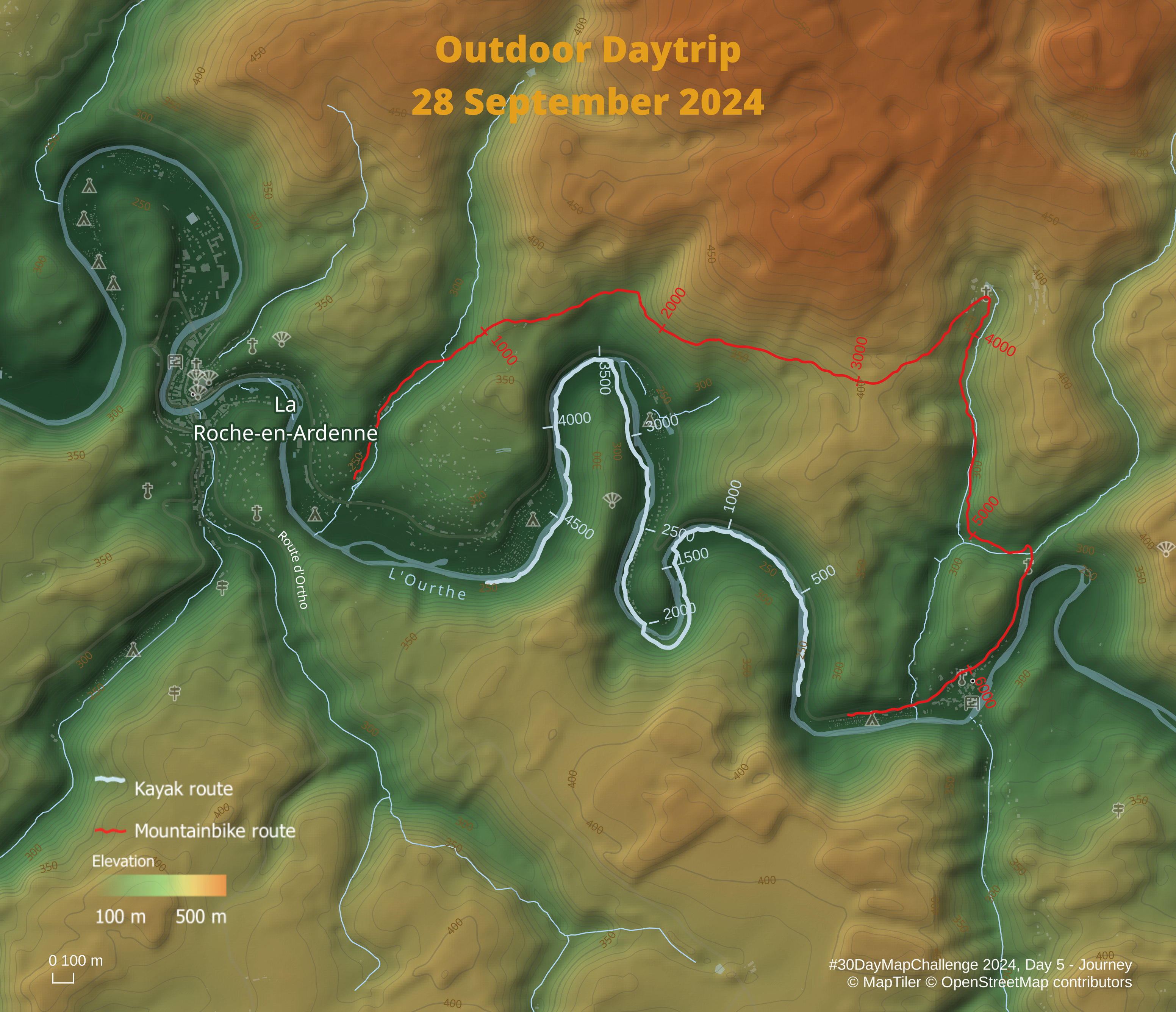
#30DayMapChallenge Day 5 - Journey
I've explored the new Linear Referencing feature in #QGIS 3.40 Bratislava and it works like a charm!
I've used my #Strava log of a mountainbike trail & kayak tour, visualised on top of beautiful #VectorTiles and #RasterTiles from #MapTiler.
Check out this video if you want to create your own outdoor maps with Strava and MapTiler: https://youtu.be/mN49IauRCqI
Přispívání do OpenStreetMap: proč vlastně?
Před několika měsíci jsem začal přispívat do OpenStreetMap a celkem mě to chytlo. Rozhodl jsem se tedy napsat seriál článků o tom, v jakých formách lze přispívat. Seriál ale musím začít tím, že napíšu o tom, proč vlastně přispívat a kde všude může být vaše práce vidět.
#Mapbox #Maptiler #mapy #OpenStreetMap #OSM #Strava #Sygic #TomTom
https://blog.eischmann.cz/2024/07/16/prispivani-do-openstreetmap-proc-vlastne/

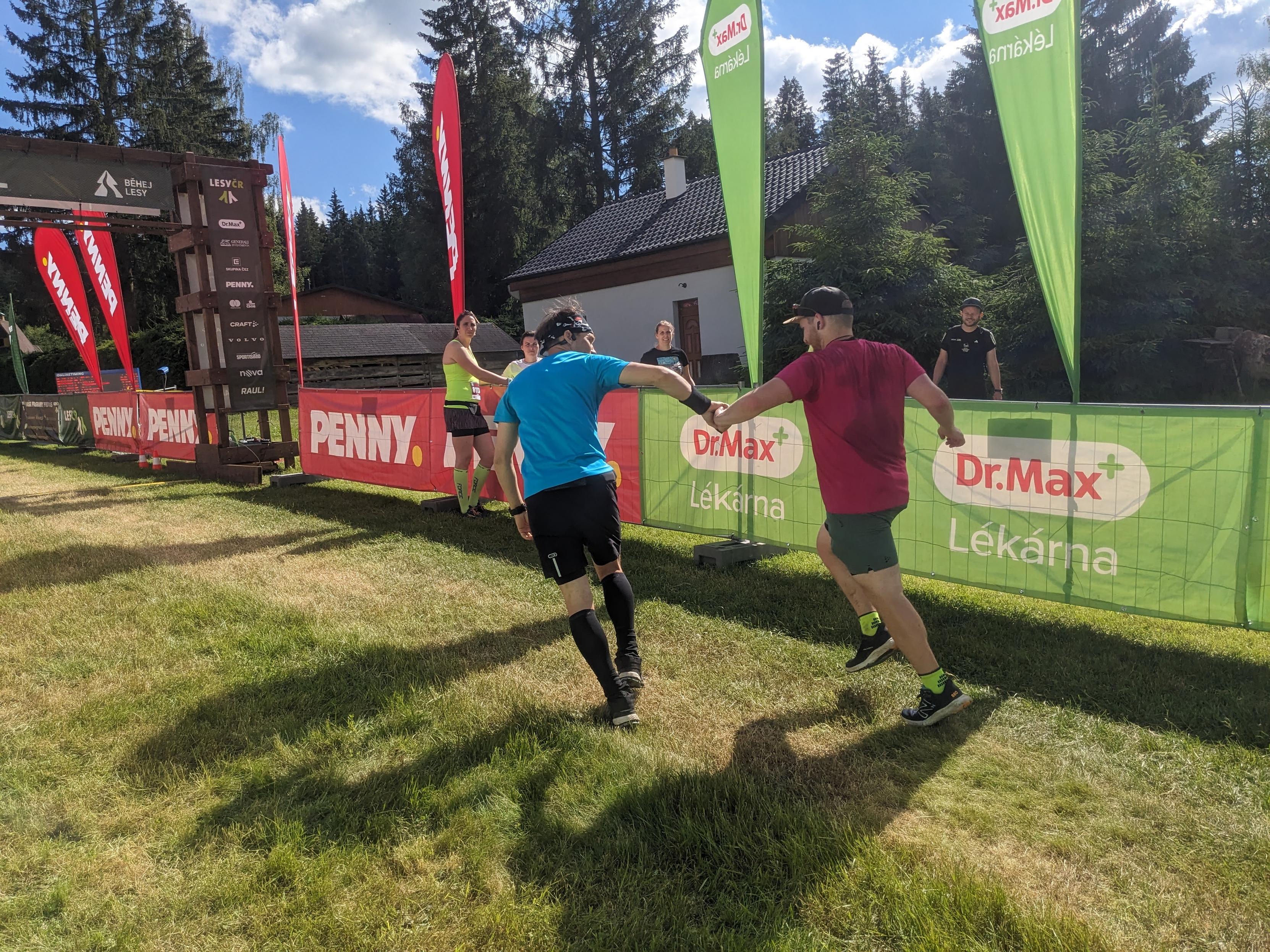
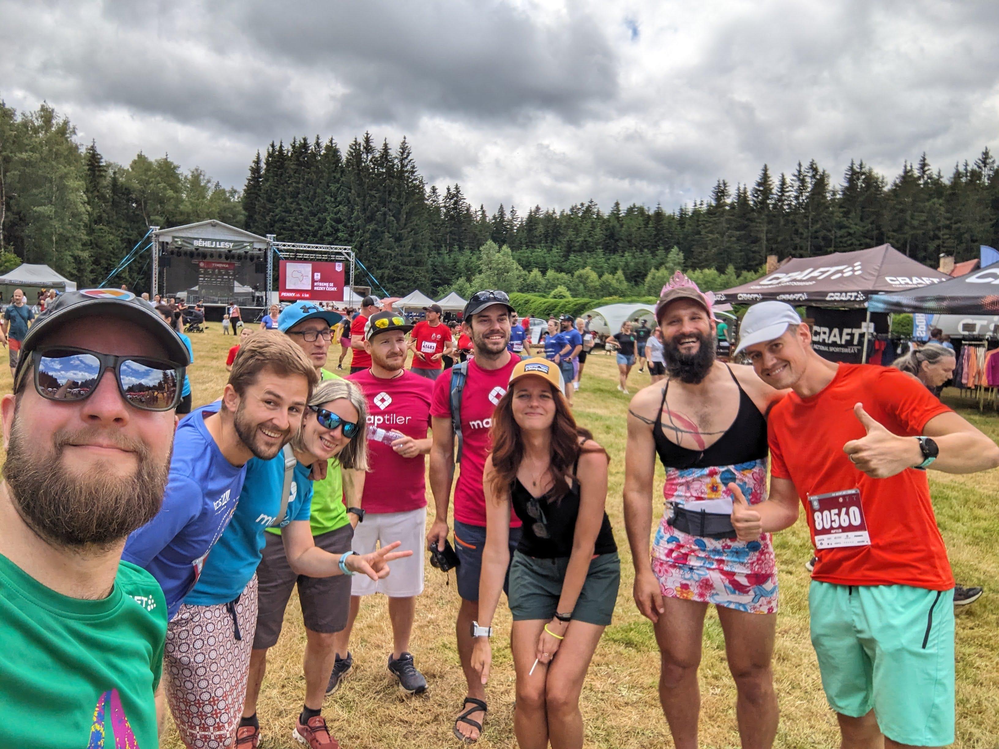
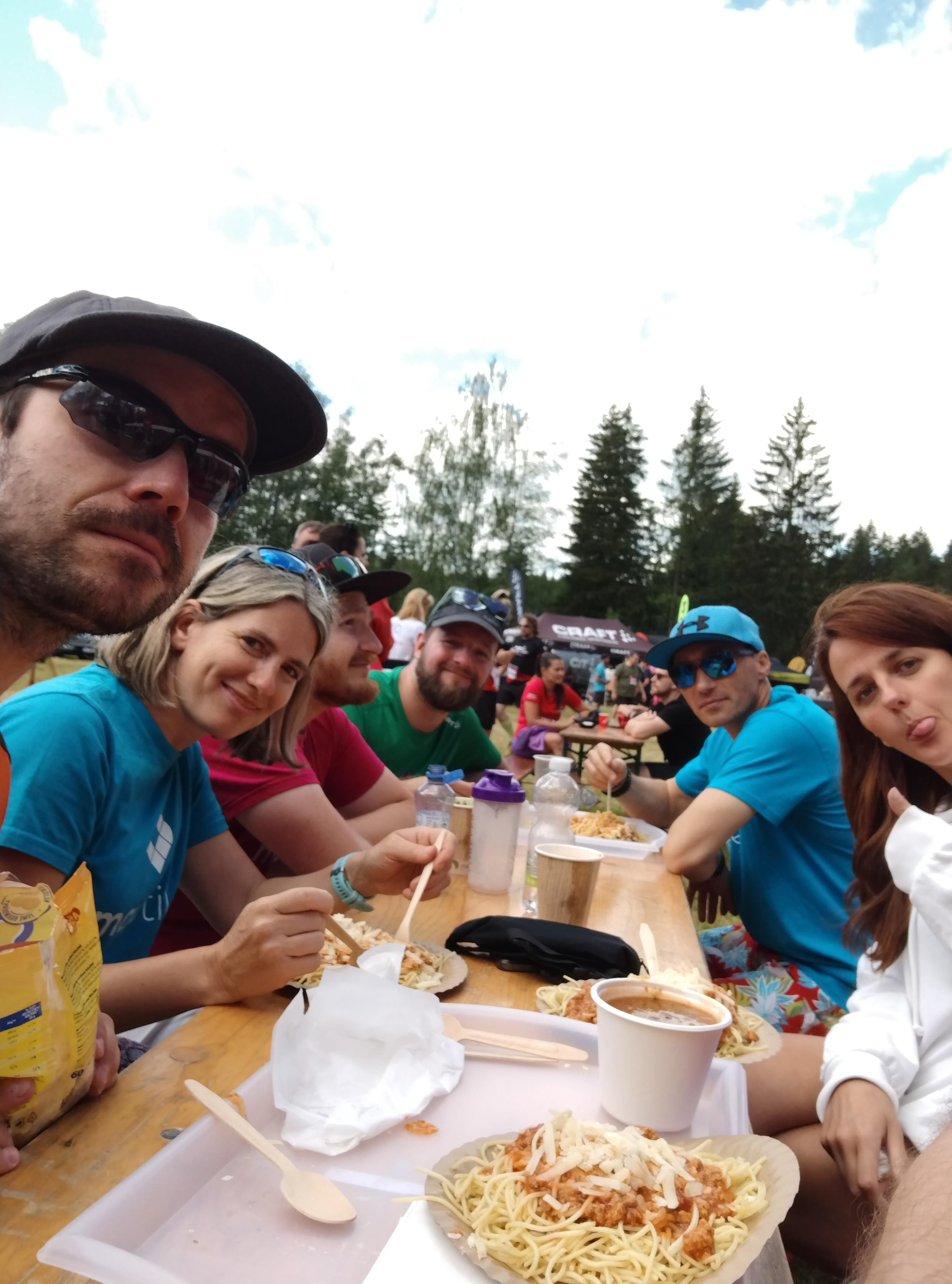
O vikendu s partou z #MapTiler jsme běhali lesy. Skončili jsme 10 v týmech na 220km. Byl to neskutečnej masakr, moje časy nebyly nejlepší, ani ideální, ale když se vám chce zvracet a chytáte křeče tak víte, že to líp nejde.
Závod moc hezky zorganizovaný, počasí ponpáteční bouřce tak akorát. Bavilo moc, bolelo víc.

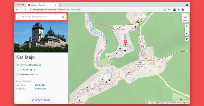
If you're exploring #OpenStreetMap like me and openstreetmap.org is too heavy for you, try #OSMapp (https://osmapp.org/). It uses #MapTiler. It's fast, looks nice and works great on the phone, too. 
Germany's most prominent TV news show, the Tagesschau, is using OpenStreetMap and Maptiler to render maps in their brand design.

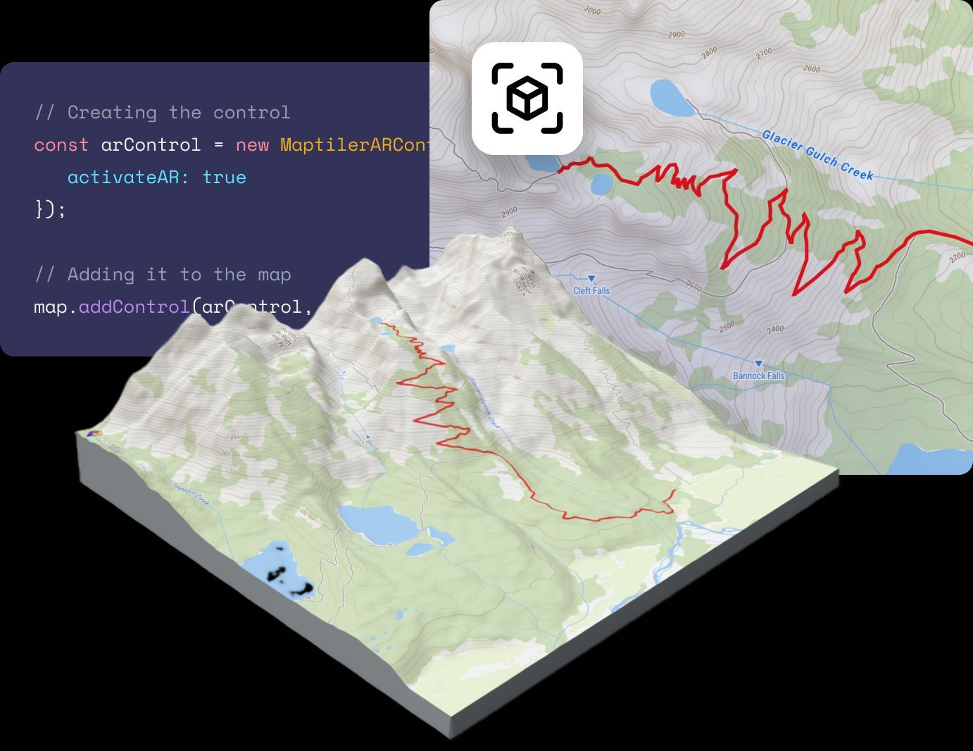
#MapTiler Augmented Reality maps made easy! Give your users a truly immersive experience on Android, iOS, #Oculus, or #VisionPro simply by adding two lines of code to your #JavaScript map. Get the code here: https://bit.ly/43WKzhv
Bridge.watch has geocoding (thanks to the free tier of #maptiler) and a hexbin rating overview map now!
Can you tell I have extra time on my hands?
@protomaps @maplibre #dataviz #mapstodon #maps #bridges #datavisualization
Tak jsme se po letech v #MapTiler dočkali. #CUZK #opendata letecké snímky konečně i v naší satelitní mapě.
Enjoy
https://www.maptiler.com/maps/#style=hybrid&mode=2d&position=7.58/49.917/14.993
#MapTiler Customize tool now has a completely new experience for #map icons.
Recolor on the fly or pick from over 200 new symbols.
Try it out here: https://buff.ly/3IwA5vH (with free MapTiler account)
#MapTiler is looking for Digital marketing analyst
https://www.maptiler.com/jobs/
Looker Studio, Google Tag Manager, Google Analytics 4, Cloudflare Zaraz

In #MapTiler I was told to create some map for today's #30DayMapChallenge
Well, I did my best. I was told, it's pretty bad.